


New Store Voting District, Buckingham County, Virginia
About
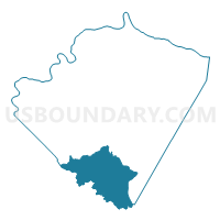
Outline

Summary
| Unique Area Identifier | 681224 |
| Name | New Store Voting District |
| County | Buckingham County |
| State | Virginia |
| Area (square miles) | 60.01 |
| Land Area (square miles) | 59.62 |
| Water Area (square miles) | 0.39 |
| % of Land Area | 99.36 |
| % of Water Area | 0.64 |
| Latitude of the Internal Point | 37.40623760 |
| Longtitude of the Internal Point | -78.55376710 |
Maps


Graphs
Select a template below for downloading or customizing gragh for New Store Voting District, Buckingham County, Virginia


Neighbors
Neighoring Voting District (by Name) Neighboring Voting District on the Map
- Agee Voting District, Appomattox County, VA
- Buffalo Heights Voting District, Prince Edward County, VA
- Curdsville Voting District, Buckingham County, VA
- Maysville Voting District, Buckingham County, VA
- Pamplin Voting District, Appomattox County, VA
- Prospect Voting District, Prince Edward County, VA
- Vera Voting District, Appomattox County, VA
- Wrights Voting District, Buckingham County, VA
Top 10 Neighboring County Subdivision (by Population) Neighboring County Subdivision on the Map
- Piney Mountain district, Appomattox County, VA (2,885)
- Appomattox River district, Appomattox County, VA (2,847)
- District 501, Prince Edward County, VA (2,722)
- District 5, Buckingham County, VA (2,680)
- District 601, Prince Edward County, VA (2,673)
- District 3, Buckingham County, VA (2,386)
- District 4, Buckingham County, VA (2,272)
Top 10 Neighboring Unified School District (by Population) Neighboring Unified School District on the Map
- Prince Edward County Public Schools, VA (23,368)
- Buckingham County Public Schools, VA (17,146)
- Appomattox County Public Schools, VA (14,973)
Top 10 Neighboring State Legislative District Lower Chamber (by Population) Neighboring State Legislative District Lower Chamber on the Map
Top 10 Neighboring State Legislative District Upper Chamber (by Population) Neighboring State Legislative District Upper Chamber on the Map
Top 10 Neighboring 111th Congressional District (by Population) Neighboring 111th Congressional District on the Map
Top 10 Neighboring Census Tract (by Population) Neighboring Census Tract on the Map
- Census Tract 9302.01, Buckingham County, VA (5,669)
- Census Tract 9302.02, Buckingham County, VA (4,455)
- Census Tract 403, Appomattox County, VA (4,321)
- Census Tract 9302.01, Prince Edward County, VA (3,666)
- Census Tract 9302.02, Prince Edward County, VA (3,571)